Weather shift should help reduce wildfire risk
Published 9:40 am Friday, August 23, 2024
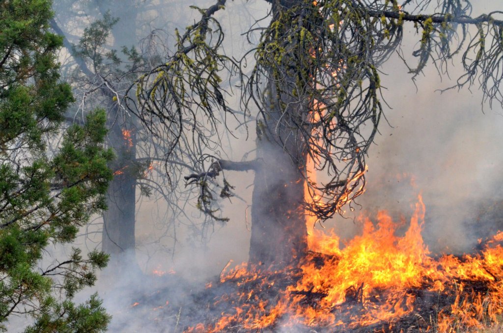
- Flames claim a tree on the Falls Fire's leading edge on July 16, 2024.
The record-breaking wildfire season in Northeastern Oregon likely won’t end for at least another month, but the danger is beginning to ease, a federal official said.
Trending
“It’s getting better,” Al Crouch, fire mitigation specialist for the BLM’s Vale District, said on Friday morning, Aug. 23. “We’re past what we typically consider our historic large fire season, which is about mid-July to mid-August.”
The shift in the weather pattern forecast for this weekend, which could bring the coolest daytime temperatures since mid-June and variable amounts of rain, will contribute to the declining fire danger, Crouch said.
“It’ll provide some temporary relief,” he said.
Trending
But this weekend’s weather offers nothing close to what fire managers consider a “season-ending event,” Crouch said, meaning the risk of large fires becomes negligible.
That usually doesn’t happen until late September or October, he said, and requires widespread precipitation, potentially snow at higher elevations, as well as much cooler temperatures.
After a heat wave in July that broke many records across the region — the temperature topped 100 degrees on 10 days during the month at the Baker City Airport, the most in any month or, indeed, any calendar year — August has been closer to typical, Crouch said.
Each passing day trims a few minutes of daylight, which Crouch said shrinks the “burning window” — the period each day when fires are likely to spread rapidly as temperature peak and humidity levels plunge.
Nighttime humidity levels tend to be higher than in mid-summer, as well.
Crouch said indexes that fire manager consider in setting fire danger reflect the moderating conditions over the past few weeks.
The energy release component, for instance, which estimates how fast a fire would spread, was at or near record highs in the second half of July.
But widespread thundershowers late in the month and in early August, along with generally cooler (although still hot) weather, resulted in the energy release component fluctuating during August, below average at times and above average at others, but staying well below record values.
Crouch said the BLM slightly reduced the fire danger on Vale District rangelands last week from extreme to very high.
“It takes a long time for sagebrush to recover from a long summer of drying,” he said.
The Wallowa-Whitman National Forest reduced the Industrial Fire Precaution Level to 2 on much of the forest (the Emily Unit remains at Level 3), which allowed firewood cutters to use chain saws daily until 1 p.m.
Level 3 is still in effect on the Umatilla and Malheur national forests.
The National Weather Service is forecasting a high temperature at the Baker City Airport of 71 degrees on Saturday, Aug. 24. That would be the coolest day at the airport since June 17, when the high was 61.
Warmer and drier weather is forecast for much of next week, but no heat waves are on tap, with temperatures remaining below 90 degrees.
Marketplace


-
eEdition

-

-
