Baker’s Balmiest
Published 7:30 am Thursday, February 7, 2019
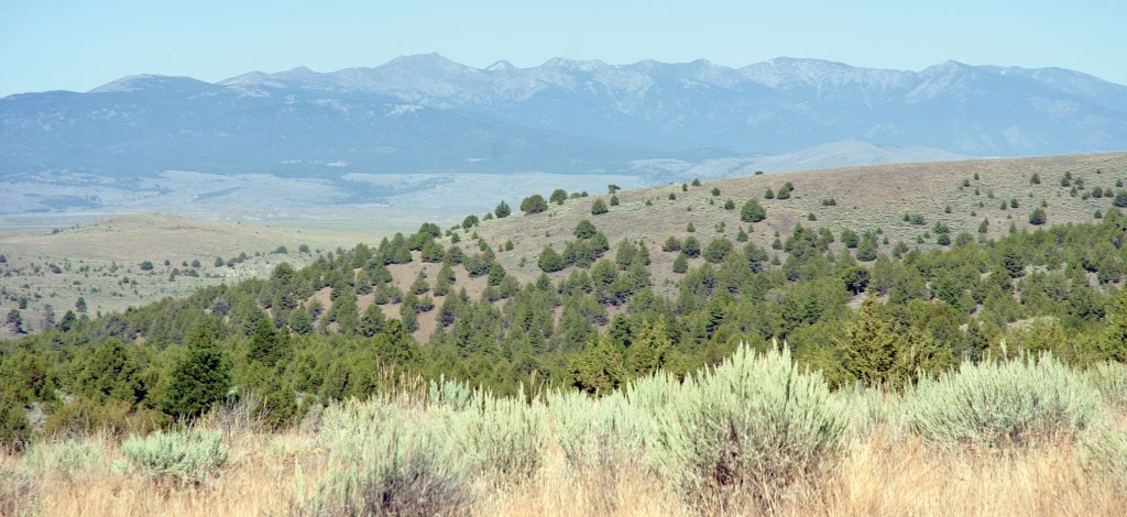
- S. John Collins / Baker City Herald file photoThere wasn’t much snow to be seen, even in the Elkhorn Mountains, during the summer of 2018. This photograph, from 2013, was made near Alder Creek southeast of Baker City.
That 2018 was the warmest year on record in Baker City might not seem surprising to anyone who endured the August heat wave that incinerated a record that had lasted more than half a century.
But it turns out that typically chilly January played a bigger role than sizzling August.
The average temperature at the Baker City Airport during January 2018 was 9.4 degrees above average.
August, despite all-time record highs being set on consecutive days, was not quite 3 degrees warmer than average.
Both July and May were also hotter, relative to the long-term average, than August was — May’s average temperature was 6.3 degrees above average, and July’s was almost 4 degrees.
Ten of the 12 months in 2018 were warmer than average. February was cooler than average by about three-quarters of one degree, and September, in a statistical anomaly, was exactly average.
All told, tallying all the daily high and low temperatures during 2018 yields a yearly average temperature of 48.0 degrees.
That’s 2.5 degrees above the long-term average at the airport, where detailed temperature records have been kept since 1944.
With its 48.0-degree average, 2018 eclipses the two previous record-setting years — 1992 and 1973 — each of which had an average annual temperature of 47.7 degrees.
But even though a cool stretch late in August demoted the month’s average temperature down to sixth-hottest on record, it was that three-day stretch, Aug. 8-10, that most of us likely will remember.
Especially the latter two days.
On Aug. 9 the thermometer at the airport recorded the astounding figure of 108 degrees. That broke, by 2 degrees, the record for the hottest temperature ever at the airport, a mark which had defied every previous heatwave since Aug. 4, 1961.
But that newly minted record lasted about as long as the solidity of a bar of chocolate would have on the airport runway tarmac on those torrid days.
On Aug. 10 the temperature crested at 109, meaning the previous day, having vanquished a record that persisted for 57 years, itself could manage to hold on for only a day.
The current record had better staying power, to be sure, as it remains at the top of the list. But whether it can retain its title for more than a half a century might be unlikely, based on a recent report about how climate change has affected Oregon, and how it might affect the state in the future.
The fourth Oregon Climate Assessment Report, which aggregates a series of peer-reviewed scientific studies from the past two years, projects, among other things, that Oregon’s average temperature could rise by 4 to 9 degrees Fahrenheit by 2100.
Such a warming trend would pose a host of potential problems for the state, the authors concluded, prominent among them more severe and longer wildfire seasons, shrinking snowpacks and the resulting loss of water for farms and ranches, and rising sea levels.
“Simply put, the state’s biggest fire years occur when summers are unusually warm and dry,” said Philip Mote, an Oregon State University professor and former director of Oregon Climate Change Research Institute and a co-author of the report. “Since warm and dry summers are occurring more frequently, we can expect the fire danger to increase as well. At the same time, our hydrology is changing — starting with shrinking snowpack, which in many basins poses a dual threat of increasing flood risk in the winter and resulting in lower soil moisture and stream flows in the summer.”
The authors note that the possible effects of a warming climate aren’t exclusively negative.
They also project that the growing season could extend as much as two additional months in the Willamette Valley, and about a month elsewhere, including Eastern Oregon.
Some of the potential ramifications could have mixed effects.
For instance, the climate report projects “extreme precipitation events” — much heavier than normal rainfall — will increase by about 20 percent in Eastern Oregon. That could help offset the reduction in winter snowpack, but it also could contribute to landslides.
In one sense Baker City lags behind Oregon as a whole in terms of record temperatures.
The warmest year statewide was 2015, when the average temperature, based on records from about 40 sites, was 50.4 degrees, breaking the previous record of 49.9 degrees set in 1934.
In Baker City 2015 ranks as the ninth-warmest year, with an average high of 47.1 degrees.
As for long-term temperature trends, the first 25 years of record-keeping at the Baker City Airport were cooler than the following two quarter-centuries.
The average temperature for the first 25-year period (1944-68) was 44.93 degrees.
The middle period — 1969-93 -— was the warmest of the trio, with an average temperature of 45.80.
The past 25 years, 1994-2018, was slightly cooler — by a little more than one-tenth of a degree — with an average temperature of 45.64 degrees.
Of the 10 warmest years at the airport, two happened during the first quarter-century of record-keeping at the airport — 1958, which ranks eighth, and 1967, the ninth-warmest.
The eight other years in the top 10 are equally divided between the most recent 25-year period (starting in 1994) and the middle quarter-century.
By contrast, the 10 coldest years are more heavily weighted to the first two 25-year periods, with four of the 10 years in each period.
Just two of the 10 coldest years have happened in the previous quarter-century — 2008, which is the fourth-coldest, and 2013, which is the 10th-coldest.
See more in the Feb. 6, 2019, issue of the Baker City Herald.


