Mountain snowpack continues to run well above average in Northeastern Oregon
Published 10:40 am Monday, February 24, 2025
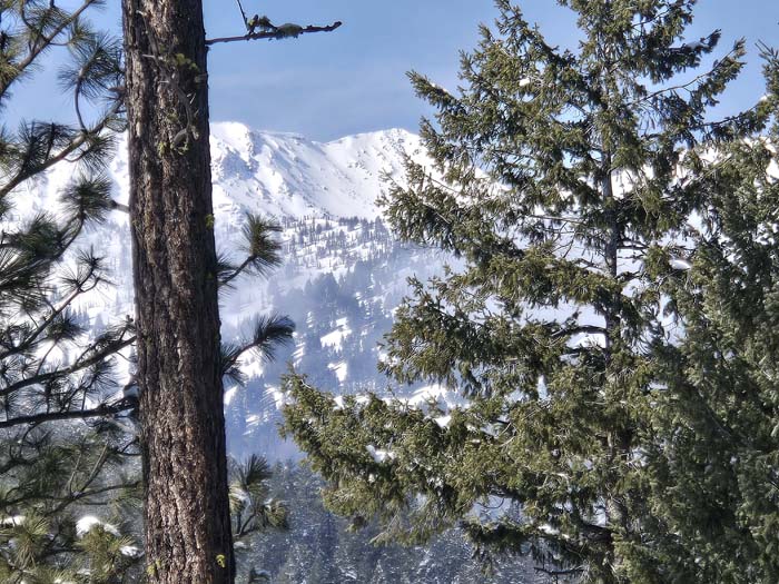
- Elkhorn Peak seen from near Marble Creek, west of Baker City, on Feb. 22, 2025.
Despite a dry stretch that lasted for most of January, the mountain snowpack in Northeastern Oregon remains well above average in most areas and is setting all-time records, for late February, at a few sites.
Trending
The first half of February brought a series of snowstorms as well as an arctic outbreak during which temperatures plunged well below zero across much of the region.
A shift in the weather pattern starting Feb. 22 ushered in milder, but still moist, air.
And so far there hasn’t been a prolonged period of warm, dry weather that could start to erode the snowpack, which typically reaches its seasonal peak from late March through early May, depending on elevation.
Trending
Snow that accumulates across the Blue Mountains is the region’s largest reservoir of water for irrigation and recreation.
A network of a few dozen automated stations, called Snotels (a portmanteau of “snow” and “telemetry”), measures both the snow depth and the more important statistic — water content (also known as snow-water equivalent).
That figure, which is based on the weight of the snow, more accurately predicts how much water will trickle into streams and reservoirs this spring and summer.
Parts of the Elkhorn Mountains west of Baker City, and the southern half of the Wallowas, have piled up snow at particularly prodigious rates this winter.
The highest water content as of Feb. 24 was at Schneider Meadows, in the southern Wallowas north of Halfway.
The water content there was 37.8 inches, the second-most ever for Feb. 24 since the Snotel was installed in 1980. The record for the date is 43 inches, set in 1999.
The Snotel near Tipton Summit, along Highway 7 between Sumpter and Austin Junction, the water content on Feb. 24 was 18.9 inches. That’s also the second-most ever measured there on that date, behind 1983, when the figure was 20.6 inches. The Snotel was put up in 1980.
The situation is similar at Gold Center, near the Sumpter-Granite Highway on the west side of the Elkhorns.
The water content at Gold Center on Feb. 24 was 15.8 inches, second only to 2006, when the reading on Feb. 24 was 17.3 inches.
At Eilertson Meadow, along Rock Creek in the Elkhorns west of Haines, the water content Feb. 24 was 14.2 inches, the third-most for that date since the Snotel was built in 1980. The record for the date is 15 inches, set in 1999.


-
eEdition

-

-
