Snow stacking up
Published 12:30 pm Wednesday, November 9, 2022
- A series of snowstorms over the past two weeks has boosted the snowpack to record or near-record levels for early November in parts of Northeastern Oregon.
Mark Bennett was, in his own words, “plodding along” through the latest in a series of early snowstorms Wednesday morning, Nov. 9 near Bridgeport.
But Bennett was happy to be driving slowly along Highway 245 in southern Baker County.
Better blizzards than drought, in Bennett’s estimation.
The flakes were falling thickly, with about 4 inches on the ground at the southern base of Dooley Mountain, said Bennett, who’s a Baker County commissioner and the owner of a cattle ranch near Unity.
“We’re still way below what we need, but it’s moisture, and it’s great,” Bennett said.
Prodigious early storms
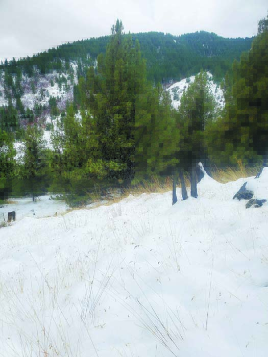
Snow often whitens the mountain peaks across Northeastern Oregon during October and early November, but rarely in the past 40 years have early storms been so potent as in 2022.
A few long-term snow-measuring sites had set all-time records for snowpack as of Nov. 8.
And others are close to the maximum for that date.
This wintry onslaught has perhaps seemed especially sudden because it followed an October that was, until the final week or so, more reminiscent of summer than of fall.
Unlike some years, there were no late summer or early autumn storms that brought a brief preview of winter, with a light dusting of snow that disappeared a few hours after the next dawn.
Since the first significant storm, which arrived Oct. 21, a series of progressively chillier systems has continued to accumulate snow not only in the mountains but, at times, in the valleys.
The result is a snowpack that’s far ahead of typical for the second week of November.
And snowpack has an importance far beyond its scenic and recreation benefits. Mountain snow is the biggest reservoir for this arid region — the key source of water to irrigate crops and to produce forage for beef cattle, both crucial contributors to the local economy.
Soaking the soil
Bennett said one of his chief worries this fall was that snow would come only after the ground, desiccated by a dry summer and early fall, had frozen.
When that happens, he said, even a deep winter snowpack can be wasted, in a sense, because much of the melting snow soaks into the soil rather than running into streams, replenishing reservoirs that supply irrigation water.
But the recent storms have considerably eased Bennett’s anxiety on that account.
Rain dampened the soil in late October, he said, and although snow earlier in November melted, the ground had not yet frozen, allowing even more moisture to soak in.
Wednesday’s snowstorm didn’t quite make it to Baker Valley, with flakes mainly confined to the southern and eastern parts of Baker County.
Bennett said there was about 1 inch of snow in Unity, but as he drove east on Highway 245 toward Bridgeport the snow deepened and was still falling Wednesday morning.
Mountain snowpack piles up
As usual, even more snow is accumulating at higher elevations.
Automated snow-measuring stations, known as Snotels, reflect the unusual generosity of the early storms.
At Taylor Green, for instance, in the western Wallowas east of Medical Springs, the water content in the snow (the most meaningful statistic when it comes to forecasting water supplies) on Nov. 8 was 3.6 inches.
That’s the most ever for that date since the Snotel was installed there in 1979, according to records from the Natural Resources Conservation Service, a federal agency that oversees snowpack measuring across the West.
At Eilertson Meadow, along Rock Creek in the Elkhorn Mountains west of Haines, the water content Nov. 8 was 1.2 inches. That’s a modest amount — the elevation at the site is just 5,500 feet — but it’s the second-highest for Nov. 8 since the Snotel was installed there in 1980. The record for the date is 1.7 inches, in 2005.
At Moss Springs, in the western Wallowas above Cove, the water content Nov. 8 was 4.9 inches, the most on that date since the Snotel was built in 1980.
A similar situation prevails across the region.
• Aneroid Lake, in the Wallowas south of Wallowa Lake. Water content Nov. 8 was 3.4 inches, the fifth-most since the Snotel went in in 1981.
• Mount Howard, also in the Wallowas near Wallowa Lake. Water content Nov. 8 was 3.3 inches, the fifth-most since the Snotel was installed in 1980.
• Schneider Meadows, in the southern Wallowas north of Halfway. Water content Nov. 8 was 3.3 inches, the third-highest total since the Snotel was installed in 1981.
• Milk Shakes, in the northern Blues north of Tollgate. Water content Nov. 8 was 5.2 inches, the most for that date since the Snotel was installed in 2007.


