Out and About: No trail, lots of choices
Published 7:35 am Thursday, June 5, 2025


The thrill of blazing my own trail began to feel more like an especially malevolent medieval gantlet the third time I lunged upward, in as many minutes, and ended up lower than I was before.
In that instant, as a dollop of stinging sweat slipped into the corner of my right eye and my heart thudded along at an alarming rate, I felt as helpless as a swimmer fighting a riptide.
I wished mightily for a trail.
I pined not for the sort of pedestrian boulevard, wide enough to accommodate a Sherman tank, common to national parks and roadside attractions where the path ends, inevitably, at a gift shop peddling a variety of huckleberry-flavored foods and sweatshirts emblazoned with bears.
I would have greeted with glee even an indistinct trace so long as I could stand upright on it, taking a temporary break in my battle against the ultimate tag team of topography and gravity.
The idea that led me to this precarious, and slightly painful, position had seemed reasonable — noble, even — while I was perusing maps on my computer.
Indeed the prospect of navigating wild country without the benefit of a route which bears a name or number kindles the spirit of adventure that smolders in most of us.
In those tranquil moments of contemplation it is easy to dismiss the reality that humans, with our peculiar bipedal gait, are rather poorly suited to getting around on steep ground littered with all manner of obstacles.
Boulders attached to the ground with the solidity of a rotten molar.
Branches dangling at the ideal height to poke eyeballs.
Fallen trees thick enough through to be carved into ocean-going canoes.
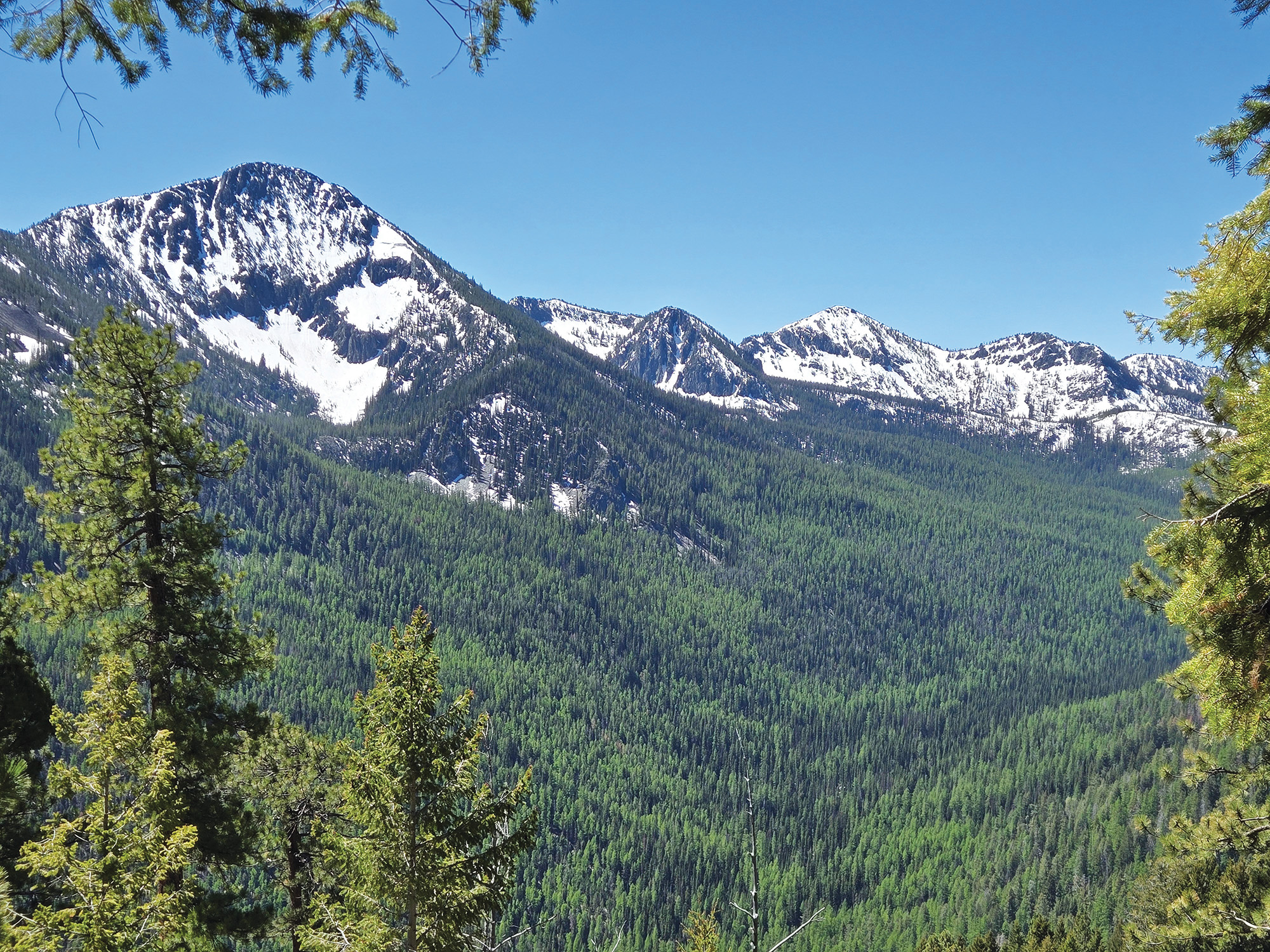
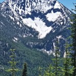
The south slope of Twin Mountain, fourth-tallest summit in the Elkhorn Mountains northwest of Baker City at 8,896 feet, is amply supplied with those impediments, and others besides.
I was quite some ways below that apex.
But I was gasping for air in the manner of a climber who, while surmounting the Hillary Step on Everest, knocks loose his oxygen tank and watches it plunge thousands of feet.
My destination was a narrow basin on the mountain’s southwest shoulder where, I have been told, sits an old cabin.
What there is not, anywhere on that mountain, is a trail.
There are two official hiking paths near the North Powder River, the major stream that flows through the glacier-carved canyon between Twin Mountain and its slightly higher neighbor south of the river, 8,928-foot Red Mountain.
Both trails are on the south side. One climbs to Red Mountain Lake, the other to Summit Lake.
Both sides of the canyon are steep, the contour lines on topographic maps — a visual representation of how severely pitched a slope is — packed almost as tightly as new pencils in a box.
This reflects the great effect ice has had on the landscape. Glaciers, being much thicker than the depth of water in a stream, plow a U-shaped furrow as they go, as opposed to the V shape of a gorge cut solely by water.
As a cursory glance at the letter U shows, the two sides are nearly vertical.
I reasoned, as I plotted my approximate route, that because I would be climbing a south-facing slope, the forest wouldn’t be as dense and the obstacles, at those of a wooden nature, would be fewer. South slopes, being exposed to much more sunlight than north slopes, tend to be warmer and drier, conditions that aren’t as suitable for dense forests since trees, like people, have a considerable thirst.
The basin I hoped to reach is along Twin Mountain Creek, the largest of several streams that tumble off Twin Mountain.
I drove the Forest Service road along the North Powder River.
Although to describe this route as a road, which implies a certain level of maintenance, stretches the definition to very near the linguistic breaking point.
The historic road, dating to the 19th century, was part of a wagon trail leading from Haines to Bourne, a mining town on the west side of the Elkhorns. The route remains but erosion has transformed it in many places into something that more resembles a stream bed than a road.
It is an excellent test of a four-wheel drive rig’s suspension.
(And of the driver’s patience, since the average speed is comparable to that of a moderately fit walker as you wend between, and sometimes by necessity bounce over, the granitic boulders with which the road is amply equipped.)
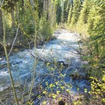
I went to the canyon on May 30, during an unseasonably warm spell, and the river, swollen with snowmelt, hummed in the background like a passing jet airliner.
The North Powder River was designated by Congress under the Wild and Scenic Rivers Act in 1988. Specifically, a 6.4-mile reach from the river’s headwaters, near Summit Lake, to the Wallowa-Whitman National Forest boundary, was designed as a scenic river.
Although the place seems pretty wild to me, no matter the congressional nomenclature.
The flank of Twin Mountain certainly qualifies for that adjective.
I hiked on the road for a mile or so and then started up the mountain, cross-country, where a stream crosses. I mistook the brook for Twin Mountain Creek, having miscounted the number of creeks on the map.
After I had climbed a thousand feet or so my elevated vantage point showed my error, and I had to traverse to the west for a quarter mile or so to Twin Mountain Creek.
Both streams — the other has no name according to several maps I consulted — were of similar character. Both tributaries plunged toward their meeting with the North Powder River in a series of frothing cascades, the spray creating miniature rainbows in the sunshine.
As I walked (and, often, slid backwards) I pondered how much even an indifferently maintained trail changes the character of a hike.
The obvious difference is that a trail — even one created by the habitual movements of elk and deer — interrupts the terrain with a relatively flat place to set your feet.
But it struck me that an even more profound effect is that the absence of a trail forces a hiker to make decisions with nearly every step.
Hiking on a trail is the pedestrian version of driving on a freeway. Both modes of travel can induce a sort of stupor. Keeping a properly aligned car within the generous lanes and gentle curves of an interstate requires no great skill, and the driver, with so little mental power devoted to the task, can consider pressing matters such as why roadside footwear so often comes in singles rather than pairs and why automobile designers put the cupholders in conflict with the shifter.
Trail hiking is similar, albeit without cupholders.
On a rocky trail, as trails in the mountains tend to be, you have to pay attention to where you step to avoid potentially ruinous orthopedic surgeon bills. But you expend no mental energy deciding on the route, since the path ahead is plain.
Not so on Twin Mountain.
As I ascended I was confronted almost constantly with choices.
Should I go left or right around the chunk of granitic rock, or might it be easier to scramble straight up?
Clamber over the fallen log or walk around it?
I was faced with decisions on the micro and macro level. As I climbed I surveyed the slope ahead, wondering which general route would be easier or at least more direct.
A few times I chose poorly and had to backtrack rather than venture onto treacherous-looking ground.
I imagined how different the hike could have been in the Wallowas. Most trails in that range were designed for horses, with plentiful switchbacks that greatly lessen the grade (and greatly increase the mileage, generally a fair trade in my view).
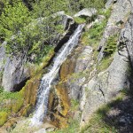
I made it to the basin. It was a magical place, even with 4-foot-deep snowdrifts covering much of the ground. Twin Mountain Creek flows placidly until it reaches the edge of the basin, where the stream plunges 50 feet or so, a miniature version of what you might see in Yosemite.
I didn’t find the cabin.