Baker County commissioners urge property owners to file appeals on wildfire risk map
Published 6:11 pm Tuesday, March 4, 2025
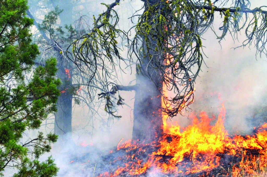
- The Falls Fire burning in Grant County in July 2024.
Baker County commissioners are urging property owners to file an appeal with the state if their parcels are listed as having a high wildfire risk and are also within the wildland-urban interface on a new state map that some lawmakers are trying to repeal.
It’s a pressing matter because the deadline to appeal to the Oregon Department of Forestry is March 10, commissioner Christina Witham said on Wednesday, Feb. 26.
The one-page appeal form is available at www.oregon.gov/odf/fire/pages/wildfire-hazard.aspx
Trending
The state sent notices in early January to owners whose property meets the two criteria — high fire risk and within the wildland-urban interface, known as WUI. These are typically residential areas within or near a forest.
Property owners can also appeal if they disagree with their risk level, or if their property is shown as being within the WUI and they believe it should not be so designated.
A county press release dated Tuesday, Feb. 25, stated that “Your Baker County Commissioners are in favor of the action taking place at the county and state levels and the more appeals submitted means that we have a greater chance at a repeal. You may not have another opportunity to appeal until the maps are revised again which could be 2030.”
Witham said the county might also send its own appeal.
Commissioners in some counties, including Deschutes, have done so. About 20% of tax lots in Deschutes County are in the high risk category and within the WUI, a total of 21,258 properties, according to The Bulletin newspaper.
Kerry Savage, Baker County assessor, said he doesn’t have an estimate for the number of parcels that are within the WUI and rated at high risk.
Trending
Parcels that meet both criteria are concentrated in certain areas, including:
• The southern and western edges of Baker Valley, particularly in the Pine Creek/Ben Dier Road/Hunt Mountain Road areas.
• Sumpter.
• Other parts of Sumpter Valley, including Deer Creek Road.
• Greenhorn (also Granite, which is in Grant County).
• Areas north and east of Unity Reservoir.
• Along Highway 7 between Salisbury Junction and near Phillips Reservoir.
• Areas along Old Auburn and Griffin Gulch roads south of Baker City.
• Sparta area.
• East Eagle Creek.
• Fringes of Pine Valley, mainly on the north and northeast.
County concerns
Earlier in February, the three commissioners signed a letter opposing the latest version of the map that shows wildfire risks for every parcel, public and private, in the state, as well as boundaries of the WUI.
Witham said county officials have been fielding questions from property owners since the Oregon Department of Forestry released the map earlier this winter.
The chief concerns, Witham said, involve tax lots that are both high risk and within the WUI — those whose owners received a mailed notice from the state earlier this winter.
Witham said the fear is that owners of such property would be required, under state rules, to take steps to protect their homes against fire. In addition, properties in the WUI that are also rated as high risk would also have to comply with different state standards if they want to build a home on the land, which could increase the construction cost.
Witham said another concern is that properties in the high risk category could either lose homeowners insurance or pay higher premiums.
Witham and other critics of the map, including state Rep. Mark Owens, the Republican from Crane whose district includes Baker County, believe the map mistakenly places some properties within the high risk zone even though the owners have taken steps, such as maintaining green grass around their home and trimming trees and brush, to reduce the fire risk.
Witham said that because state officials didn’t inspect each private parcel, the map doesn’t account for that sort of work.
A recent letter to the state from the Eastern Oregon Counties Association makes the same complaint, stating: “This approach ignores the significant wildfire mitigation efforts already undertaken by many property owners, including the creation of defensible space and the use of fire-resistant materials.”
Owens wrote in a recent newsletter that the current map, which was changed after widespread complaints about inaccuracies in the map the state released in June 2022, is “still wrong.”
“They are devaluing property, creating unnecessary concerns about home hardening, and not giving credit to the work that has been done,” Owens wrote. “I believe we have bipartisan support this session to get these maps repealed.”
Creating the map was part of a bill the Oregon Legislature approved in 2021, in the wake of the Labor Day 2020 blazes that destroyed hundreds of homes in western Oregon.
About Jayson Jacoby | Baker City Herald

Jayson has worked at the Baker City Herald since November 1992, starting as a reporter. He has been editor since December 2007. He graduated from the University of Oregon Journalism School in 1992 with a bachelor's degree in news-editorial journalism.
 More by Jayson Jacoby
Marketplace


-
eEdition

-

-
