Weekend storm forecast to end long January dry spell in Northeastern Oregon
Published 10:05 am Tuesday, January 28, 2025
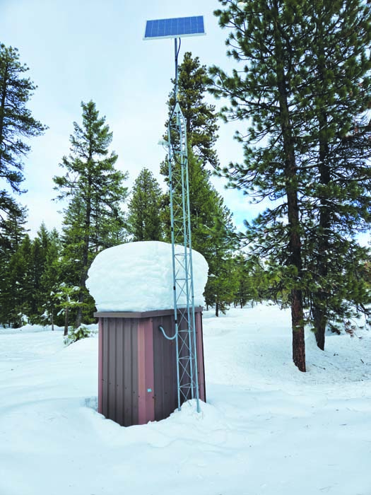
- The Tipton Snotel automated snow-measuring station, near Highway 7, on Jan. 12, 2025.
After a boisterous start, January weather in Northeastern Oregon has been about as tranquil as a cat napping in a patch of sunshine.
Trending
But the month’s end could mark a major pattern shift.
The first week of February is likely to bring the first major storms in a month to the region, according to the National Weather Service.
The agency is forecasting widespread snow, with possible rain or freezing rain at lower elevations, starting Friday, Jan. 31, and continuing at times into next week.
Trending
“A significant pattern change to wet weather commences on Friday,” according to a forecast discussion issued Tuesday morning, Jan. 28, by the National Weather Service office in Boise, which handles forecasts for Baker, Harney and Malheur counties.
The Weather Service office in Pendleton, which forecasts for the rest of Northeastern Oregon, agreed.
“An active period of weather is in store for the region through the extended forecast,” according to the forecast discussion Tuesday morning. “There is growing confidence in breezy conditions going into the weekend with periods of rain and snow in the lower elevations and snow in the mountains.”
January’s stormy start
Most of the region has been dry since Jan. 6.
That includes the Baker City Airport, where no measurable precipitation has fallen since Jan. 5.
The month’s first five days were sufficiently damp, though, to ensure that this January is wetter than average despite more than three weeks of dry weather.
During that period the airport recorded 1.11 inches of rain and melted snow, including a daily record of 0.84 on Jan. 3. The long-term for January is 0.82 of an inch. This January is the wettest at the airport since 2010, when the total was 1.2 inches.
Other soggy starts include:
• Eastern Oregon Regional Airport, Pendleton, 1.11 inches from Jan. 1-6 (the airport also recorded 0.01 of an inch on Jan. 8, and 0.03 on Jan. 10. No measurable precipitation has fallen at the airport since then.
• Meacham, 2.24 inches from Jan. 1-6. Another 0.24 of an inch fell on Jan. 10, but Meacham has been dry since.
• Hermiston, 0.94 of an inch from Jan. 1-4, with no measurable precipitation recorded since.
Since the first week of January, a persistent pattern has prevailed across Oregon and much of the West, with a strong ridge of high pressure anchored off the coast. High pressure ridges deflect the Pacific storms that usually roll through the region regularly during winter.
Snowpack scarcely affected
Placid weather during January typically is associated with the midwinter thaw, a spring preview that intervenes occasionally in what statistically is the coldest month in most places.
But this January doesn’t qualify.
Although temperatures were generally above average across the region, there was no extended stretch of abnormally balmy weather.
Indeed, since the middle of January an intrusion of modified Arctic air has kept temperatures, particularly at night, near or in some cases below average.
At the Baker City Airport, for instance, the coldest temperature during December was 16 degrees, the highest “low” for the month on record. The previous record was 14 degrees in December 2023. Temperature records at the airport date to 1943, and in more than half the Decembers since the temperature has dipped below average.
(Often well below zero, including the all-time record of 39 below on Dec. 30, 1978.)
From Jan. 20-27, 2025, the temperature at the airport plunged below 10 degrees on four days, including the monthly minimum of 4 above zero on Jan. 26.
The lack of a chinook wind helped preserve the mountain snowpack that accumulated to record or near-record levels by the first week of January.
The snowpack is the region’s biggest and most important source of water for irrigation, drinking and recreation.
Despite more than three weeks of dry weather, the snowpack barely shrank in most places. A few measuring sites even gained slightly, likely due to either a brief storm on Jan. 10, or from the accumulation of frost during the extended period of clear, cool weather.
Snowstorms between Christmas and the first week of January were especially prodigious in the southern Wallowa Mountains, in parts of the Elkhorns and the southern Blues.
At Schneider Meadows north of Halfway, for instance, the water content in the snowpack on Jan. 9 was 26.9 inches, the second most measured on that day since the automated measuring station was installed in 1980 (the record is 27.5 inches, set in 1997).
The absence of storms over the next three weeks had only a minuscule effect on the water content, which dropped a fraction to 26.6 inches as of Jan. 28.
Because January typically deepens the snowpack, the extended dry spell has affected the water content’s historical ranking. As of Jan. 28 the water content had dropped from runner-up to sixth-most on record. The 26.6-inch reading is the most for the date since 1999 (30.3). The all-time record for Jan. 28 is 31 inches, set in 1995.
At Eilertson Meadow, in the Elkhorn Mountains northwest of Baker City, the record water content of 10.1 inches on Jan. 9 had shed the tiniest amount by Jan. 28, to 10.0 inches.
But that had dropped from the top of the list for the date to fifth-most. The record for Jan. 28 is 11.2 inches, set in 1989.
At Taylor Green, in the western Wallowas southeast of Union, the water content on Jan. 9 was 19.8 inches, by far the most ever measured there on that date (the previous record was 15.4 inches, in1997).
Despite three weeks of dry weather, the water content rose slightly, to 20.2 inches, on Jan. 28. That is the second-most for that date, behind only the 20.6 inches measured in 1989.
Refilling a reservoir
The bountiful early snowpack raises the prospect of one of the region’s biggest reservoirs — Phillips, about 17 miles southwest of Baker City — refilling for the first time since the spring of 2017.
Forecasting the reservoir level is difficult due to factors that can’t be predicted in advance, particularly how quickly the snowpack melts and how much of the water soaks into the ground rather than trickling in the reservoir.
Since 2017, Phillips reached its peak volume in June 2023, at 53,602 acre-feet of water (about 73% of capacity).
Compared with 2023, there is quite a lot more water in the reservoir today — 20,000 acre-feet on Jan. 28, compared with just 2,200 acre-feet on the same day in 2023.
The water content in the snowpack meanwhile, is higher now at a key measuring station than it was two years ago. The Bourne Snotel, about six miles north of Sumpter, is near the headwaters of Cracker Creek, which flows into the Powder River and thence into Phillips Reservoir.
The water content at Bourne on Jan. 28 was 11.9 inches, compared with 10.8 inches on the same date in 2023.
Last year, however, explains the challenge of using past years to predict the future.
In 2024 the reservoir held more water on Jan. 28 than it does now — almost 26,000 acre-feet. And the water content at Bourne on Jan. 28, 2024, was 11.2 inches, only slightly less than it is now.
But less of that snowpack made it to the reservoir compared with 2023, and the reservoir’s peak was almost identical to that year, at 53,400 acre-feet.
Marketplace


-
eEdition

-

-
