COLUMN: Appreciating the magnificence of Mount Jefferson
Published 10:03 am Friday, October 25, 2024
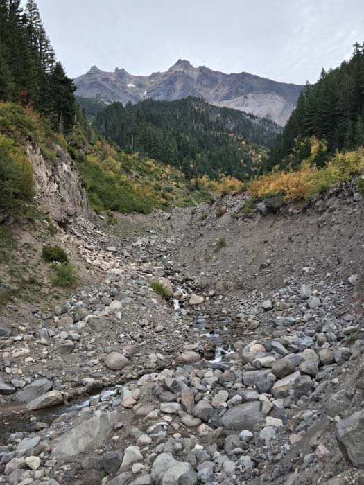
- Mount Jefferson, Oregon's second-highest peak at 10,497 feet, looms above Milk Creek along the Pacific Crest Trail.
I grew up within sight of Oregon’s second-tallest mountain but only recently, more than three decades after I moved away, did I step onto its slopes.
Mount Jefferson is one of the great craggy volcanoes that jut, like rarely brushed incisors, from the jawbone of the Cascade Mountains. The tip of its crumbling pinnacle is 10,497 feet above sea level.
In Oregon only Mount Hood, at 11,239 feet, is taller.
I lived for my first 18 years in Stayton, a farming town about 15 miles east of Salem.
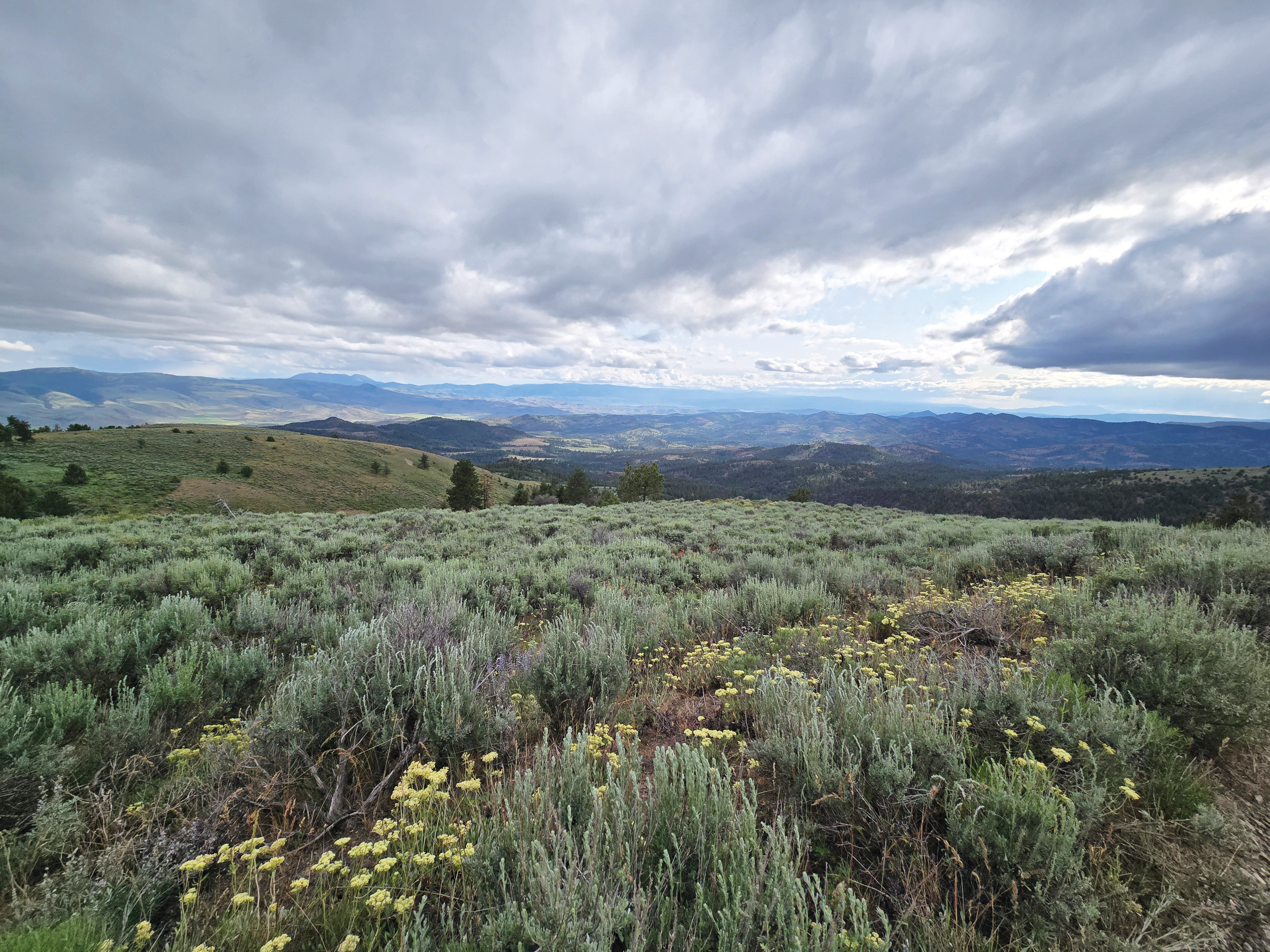
Stayton is near the eastern edge of the Willamette Valley, where that sprawling flatland meets the Cascade foothills that stretch for more than 30 miles east to the range’s crest.
Although I couldn’t see Mount Jefferson from my house, I had only to walk a couple blocks, to where the athletic fields around my alma mater, Stayton Union High School, opened the view to the east. There I could see, in fair weather, the whole west face of Jefferson, snowy most of the year and prominent even at a distance of about 50 miles.
I was fascinated with the mountain. Its bare rock and constant snow seemed to me a wholly different world from the green, temperate and frequently damp valley where I lived.
I always supposed that people in India felt much the same when they looked at the distant Himalayas.
The Cascades are quite different, in composition and in appearance, from the Elkhorns and the Wallowas.
The latter ranges, both of which I can see from my home, are a series of alternating ridges and canyons. Most of the summits are points that rise above a ridgeline, the difference in elevation often just several hundred feet. The summits in many cases are only a mile or two apart.
Cascade volcanoes are by comparison solitary peaks.
With exceptions such as the Three Sisters west of Bend, a trio of summits that all top 10,000 feet (there are five altogether in Oregon, Mounts Jefferson and Hood being the others), the dominant peaks in the Cascades are typically 20 miles or more distant from each other.
Between those eminences, the Cascades’ topography isn’t especially dramatic, lacking the deep, glacier-carved canyons that distinguish the Elkhorns and the Wallowas.
Their isolation allows Cascade volcanoes, and in particular the taller ones such as Jefferson or Hood, to command their surroundings more thoroughly than any individual peak in the Elkhorns or the Wallowas can.
Mountaineers define this as “prominence.”
It’s measured in feet, the difference between the summit and the mountain’s base.
The latter is not so precise, of course, since the point where a mountain begins is not so obvious as where it ends.
But prominence is a meaningful way to gauge any mountain’s presence on the landscape, the extent to which it dominates the horizon.
By that standard, Mount Jefferson has few rivals in Oregon.
Consider as a comparison two examples in Northeastern Oregon — Elkhorn Peak and Chief Joseph Mountain.
The former is the highest summit in the Elkhorns visible from much of Baker City (including my backyard). Its prominence is about 5,500 feet.
Chief Joseph Mountain, when viewed from Joseph, has a prominence of about 5,400 feet.
Mount Jefferson, when seen from along Highway 22 near Idanha, about 30 miles east of Stayton, towers more than 8,000 feet above the road.
I was much closer to the peak, albeit about 3,000 feet higher in elevation, on the afternoon of Oct. 11.
I hiked the Woodpecker Ridge Trail to the Pacific Crest Trail, then south on the PCT for a couple miles to its crossing of Milk Creek.
Short of climbing the peak — a daunting and dangerous task, given the steep, crumbling lava of which the mountain is constructed — this is perhaps the most dramatic vantage point of Jefferson.
It wasn’t always so.
Until four years ago, a dense forest blocked most views from the PCT. But the Lionshead Fire, one of the blazes that devastated Western Oregon during the Labor Day weekend in 2020, scorched most of the trees in the area.
Now the view of the mountain’s west side — the flank most heavily eroded by glaciers, although Jefferson’s remaining glaciers are mainly on the east and north slopes — is largely unimpeded.
I was captivated.
Mount Jefferson is a minor mountain by the standards of the world’s great ranges such as the Himalaya, the Alps or the Andes. And even among the Cascades it falls short, in height and bulk, of peaks such as Rainier and Shasta.
But from the junction of the Woodpecker Ridge and Pacific Crest trails, Jefferson seems as grand as any mountain, the absolute master of the local topography.
It inspires awe as only a natural feature can, whether it’s a mountain or a waterfall or a great precipice.
As I walked along its slopes I thought occasionally of those distant days, and distant views, and marveled at how much difference the span of a few dozen miles can make.