Stakeholders seek consensus for forest management
Published 2:00 pm Wednesday, February 16, 2022

- Harvey
JOHN DAY — Groups that have long been at odds on forest management issues have reached a consensus on goals and desired conditions that will frame how the U.S. Forest Service drafts land management plans on three national forests in Northeastern Oregon and Southeastern Washington.
Trending
At a meeting on Jan. 25, the access subcommittee of the Blue Mountains Intergovernmental Council — or BIC for short — submitted its final rule and desired conditions to the full council.
The Forest Service formed the BIC, made up of county officials, tribal members and other stakeholders from the Blue Mountain region, after the agency’s proposed 2018 management plan revision fizzled in the face of intense public scrutiny.
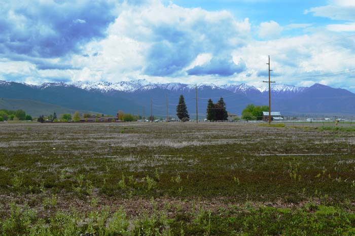
The three national forests covered by the management plan — the Umatilla, Wallowa-Whitman and Malheur — are collectively known as the Blue Mountain Forest and make up a third of Oregon’s national forest land.
Trending
Each forest has its individual resource and management plans, with desired conditions and goals spelled out. While the plans do not dictate project-level decisions, the desired conditions will form a foundation for the broader guidelines surrounding key issues such as forest access, elk security, forest health and grazing when the Forest Service begins the process of revising its management plan for the Blue Mountain Forest.
Craig Trulock, Malheur National Forest supervisor, said he is not sure when the revision process would begin. However, he said a proposal has been forwarded to U.S. Forest Service headquarters in Washington, D.C., to put a team together to begin drafting the revision.
From the beginning, Trulock said, the idea was to seek compromise and solutions on as many issues as possible.
“I think we made huge progress with the BIC on understanding each other,” Trulock said.
The Forest Service’s 2018 management plan revision, which was drafted before Trulock was named Malheur’s supervisor, received intense backlash. The plan called for an increase in thinning dry upland forests to improve wildfire resilience while doubling the current timber harvest and designating 70,500 acres of new wilderness.
The Eastern Oregon Counties Association, to which Baker and Grant counties belong, listed eight main objections, including economics; access; management area designation; pace and scale of restoration; grazing; fire and salvage logging; coordination between agencies; and wildlife.
The counties argued the agency’s plan would close roads and limit livestock grazing while failing to thin enough of the woods to boost timber jobs or lower the risk of large wildfires.
The BIC subcommittee revised the list of conditions pertaining to a number of key issues, including access, elk security, wilderness and other set-asides.
Forest access
In its final draft document of desired conditions, the BIC’s access subcommittee wrote forest access was the most contentious topic during the 2018 forest plan revision process.
Committee member Bill Harvey said the forest roads have been used by people in rural areas for 75 to 80 years.
Harvey, chairman of the Baker County Board of Commissioners, said people have lived, worked and played in the Blue Mountains their whole lives.
“Why, in God’s name,” Harvey said, “would we want to take that right away?”
Public use
The group writes that the public desires to be well informed on forest access. It wants the agency to provide an up-to-date and comprehensive inventory of all forest roads and the status of those roads.
This was an important desired condition for subcommittee member Mark Owens, a state representative from Crane, who told the Blue Mountain Eagle last year that he understands certain areas have wilderness or wildlife designations restricting motorized vehicle access. But he wanted to learn what roads are open and what roads are closed and why they are closed.
He said he wanted to see which roads were closed through the National Environmental Policy Act and which roads were closed by the Forest Service administratively.
“If they’re closed through NEPA, we really can’t get it back open unless we go through NEPA, but if you’re closed administratively, then those are open for a conversation on the subject,” he said.
According to the final document, “use restriction of a road previously reviewed and approved through the NEPA process should be clearly and effectively posted for the public and reflected on updated maps.”
Elk security
The group writes that forest road and trail system use, density and habitat conditions may have some negative effects on wildlife in general and specifically on elk distribution.
The desired condition is that habitat is managed to provide a balance of adequate nutritional resources, cover, and human disturbance regimes so we encourage elk to remain on public lands. Collaboration and coordination occur that benefits these desired future conditions by addressing the many other factors such as predation, hunting, and private land practices that also effect elk distribution while providing year-round recreational and cultural opportunities and limiting agricultural damage on private lands.
User-created routes
The desired condition is to establish objective criteria for user-created routes, such as evaluating historical maps and aerial imagery to determine if the agency should include the forest system.
The routes would be evaluated and analyzed at the project level for social, cultural, historical, economic, habitat and environmental concerns while, at a minimum, seeking to ensure access in the general area.
The evaluation would coordinate with local and tribal governments with ample public notice and involvement through the NEPA process. As a result, the public and groups that frequent the routes would be well informed and allowed to comment on changes in management actions.
Wilderness, habitat and set-asides
Last year the subcommittee asked the Forest Service’s Dennis Dougherty, a recreation planner, Nick Goldstein, a regional planner, and Trulock about the process of recommending set-asides within a forest plan.
Dougherty talked about the difficulties during the 2018 plan revision. However, he told the group his biggest takeaway was complying and comporting each component with the overarching forest plan.
Dougherty said it is important to remember the forest plan does not designate motorized usage on forest roads. Instead, those provisions come from the travel management plan.
He also told the group that some areas are statutorily designated. Also, he said, Congress identifies certain set-asides as well.
He explained a Forest Service document, the “suitability-rating table,” used during the last revision, which lists management areas, activities, land allocations and designations that the forest can use to make access and land-use recommendations.
Dougherty said he recognized the framework as cumbersome and complicated because of the plan amendments over the years. However, he said it is the Forest Service’s general approach to determining land uses.
The Forest Service’s Tom Montoya said these administrative recommendations go through a review process under the National Environmental Policy Act.
Trulock said the goal was to come to a collective understanding about the Forest Service’s process: Even if there are no additional set-asides, they still have to go through the analysis to get to that point and make that recommendation.
The final draft of the desired condition was to understand that the forest service has to evaluate the suitability and eligibility through the forest planning process for future set-asides.
That said, the subcommittee does not see the need for any additions to set-asides.
Baker’s minority report
Harvey submitted a minority report disagreeing with the BIC access subcommittee’s final draft of the desired conditions document.
Harvey writes that special interest groups, agencies, and tribes disregarded forest management principles the Eastern Oregon Counties Association compiled in a 2019 document throughout the subcommittee meetings. Meanwhile, Harvey noted that this let other counties make too many concessions.
Harvey writes that Baker County submitted several edited versions of desired conditions, and the subcommittee offered “minimal regard” for the county’s input.
Local governments know their counties best, Harvey writes.
“And it’s ridiculous to be overridden by committee members that have no authority or knowledge of what is best for the citizens of this county,” Harvey added.
Trulock said that the BIC’s charter allows for the submission of the minority report.
Ultimately, he said, the Forest Service would have to make decisions through the forest planning effort, which will include alternative drafts and a public comment period.
Grant County Commissioners Jim Hamsher and Sam Palmer, who both served on the BIC, said they knew there would need to be compromises.
“You’re never going to get everything you want,” Palmer said.
He said he was happy that all of the entities began working with each other early in the process, which, he said, did not happen in 2018.
“We brought all the agencies up to the table at the front end instead of the back end,” Palmer said. “In two years we had a product when before they had one that got scrapped after 15 years.”
Marketplace


-
eEdition

-

-
