Pack Is On Track
Published 1:46 pm Tuesday, January 22, 2019
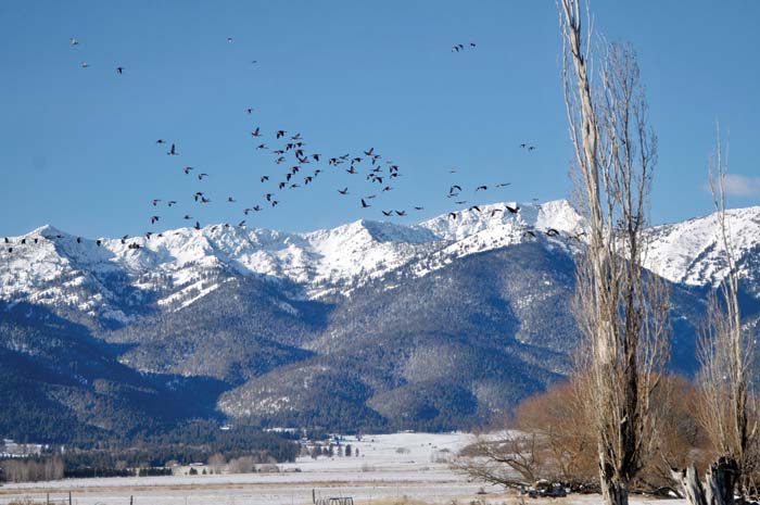
- Kathy Orr/Baker City HeraldRecent storms brought snow to Baker Valley and thickened the snowpack in the Elkhorn Mountains.
Wes Morgan is trying to nurse his ailing diesel pickup truck through zero-degree weather in Sumpter Valley, but he doesn’t begrudge the chill in one respect.
Trending
It saves the snowpack.
And this is a winter, Morgan said, when every flake is valuable.
After the drought that dominated 2018, only a hefty winter snowpack is likely to recharge springs and refill reservoirs, said Morgan, who manages the Burnt River Irrigation District in southern Baker County.
Trending
“It would definitely benefit us to have a better snowpack,” Morgan said this morning.
So far this winter’s version shows more promise than its predecessor did.
As of Jan. 1, the water content in the snow at 13 sites around Northeastern Oregon was higher than a year ago at all 13 locations.
And the water content — which is a more telling measurement than the depth of the snow — was above average at eight of the 13 sites.
In parts of the Elkhorn Mountains west of Baker City, the snowpack is more than twice as bountiful as it was at the start of 2018.
An automated snow-measuring station near Bourne, for instance, is reporting a water content of 6.8 inches, compared with 2.5 inches a year ago.
At Eilertson Meadow, along Rock Creek west of Haines, the current water content of 5.5 inches is almost four times more than last year’s 1.4 inches.
The situation is a bit different in the Wallowa Mountains.
The snowpack there is also deeper than a year ago, but the water content is below average for Jan. 1 at a few sites.
Those include Schneider Meadow north of Halfway. The water content of 11 inches is more than double what it was last year, but it’s about 11 percent below the long-term average for the start of January.
It’s still early in the snowpack season. Typically the mountains amass half or more of their seasonal snowpack after Feb. 1, and in many years March is the snowiest month.
Marketplace


-
eEdition

-

-
