Back on the byway
Published 1:05 pm Friday, July 28, 2017
- Back on the byway
We had a decision to make, and our lack of Dramamine was a major factor in the discussion.
Trending
When it comes to in-vehicle vomiting and the selection of driving routes, I put a much higher priority on straightness than on distance or time.
Which is to say I’d rather drive an extra 15 or 20 miles than try to scrub stains out of the upholstery.
Besides which that aroma clings with a stubbornness that would shame a barnacle.
Trending
We were confronted with this conundrum, my wife Lisa and I, after hiking to Crawfish Lake last Sunday with our kids, Olivia and Max, and our friends Meggan and Stuart Hills and their four sons.
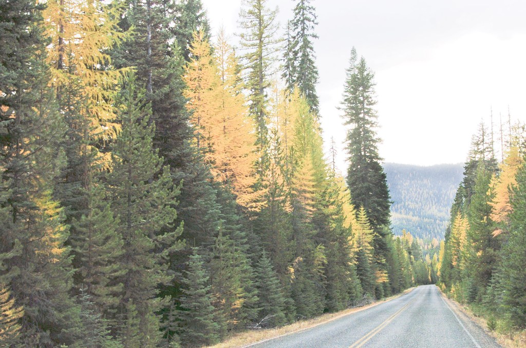
The trailhead is along the Elkhorn Drive Scenic Byway, a 106-mile two-lane paved route that circles the Elkhorn Mountains west of Baker City.
We had driven from Baker City through Haines and Anthony Lakes — counterclockwise on the loop, that is. As we packed our gear we pondered whether to retrace that route or to head south to Granite and complete the loop.
I calculated, in the seat-of-the-pants fashion I typically employ, which has a margin of error of plus or minus 50 percent, that going by way of Granite would add about 15 miles.
But we would avoid the nearly constant curves between the trailhead and the North Powder River, where the byway disgorges from the mountains and enters Baker Valley.
We picked the option that was longer but less likely to upset any passenger’s equilibrium.
Also we promised cold drinks at The Outback store at Granite, a mere 14 or so miles away.
Although the potential for nauseated children drove our decision, I was secretly pining to finish the loop anyway, something I hadn’t done in at least a few years and perhaps as many as five.
(I don’t keep a diary, and my memory is about as reliable as my ability to estimate road mileages.)
This struck me as an inexcusably long interval — akin to a Portland resident failing to visit Timberline Lodge occasionally, or someone from Klamath Falls who hasn’t seen Crater Lake for a decade.
The Elkhorn Drive is such a beautiful trip, and so accessible to me, that to neglect it for even a few years seems to me a great waste of such grand scenery.
Worse still, I can’t proffer the pathetic excuse that, well, I’ll get around to it this fall.
The Elkhorn Drive doesn’t brook procrastination. The geography that distinguishes the route among more mundane journeys — which is most journeys, after all — also severely constricts the time frame for travelers.
Some years the entire byway is open for scarcely more than four months, so early does heavy snow arrive in autumn, and so reluctant it is to yield come spring.
(The sections from Baker City to Anthony Lakes, and from Baker City to Granite, are open year-round.)
Officially the Elkhorn Drive starts in Baker City (and, as the nature of loops dictates, ends there as well). But for drivers coming from Union County and points north it’s handier to take the North Powder exit on Interstate 84 and head for Anthony Lakes.
The stretch between the North Powder River bridge and the North Fork of the John Day River — about 26 miles — boasts the most imposing scenery. Between those points the byway climbs almost 4,000 feet up the granitic northern flank of the Elkhorns and then uncoils for about 2,000 feet down the west slopes.
There are fine views at several places, including the Forest Service’s Baker Valley Overlook, which has plenty of space to pull off the road and park, about 4.8 miles from the North Powder River bridge.
My favorite vista, though, happens about three miles farther, just before the turnoff to the Van Patten Lake trailhead. There the byway runs straight for a quarter mile or so, aiming at the northeast face of Van Patten Butte, an 8,700-foot peak where snow patches lie until well into August.
About two miles past Anthony Lakes, the byway reaches its apex at 7,392-foot Elkhorn Summit. It’s the second-highest summit on a paved road in Oregon, behind only the Rim Drive in Crater Lake National Park, which tops out at about 7,900 feet.
From Elkhorn Summit to the North Fork John Day the byway could serve as a classroom for wildfire ecology.
If you stop at the Summit and look west you’ll see the remnants of the Silver fire from 1986.
Several miles farther, where the byway follows a ridgeline, the view to the south takes in the slopes nearly denuded of trees during the 10,000-acre Sloans Ridge fire in 1996.
At the North Fork, where there’s a fine campground, the Elkhorn Byway meets the Blue Mountains Scenic Byway, which ends at this intersection. Turn left toward Granite (the Blue Mountains Byway heads northwest toward Ukiah, 41 miles away. Travelers can also return to La Grande, via the 51 Road north toward Starkey, eventually connecting with Highway 244.)
Forests, mainly of lodgepole pine, dominate the 23 miles of byway from the North Fork to Sumpter.
An exception is the descent from Blue Springs Summit, about midway between Granite and Sumpter, where the west face of the Elkhorns looms, capped by the distinctive thumb of Rock Creek Butte, at 9,106 feet the highest point in the Elkhorns.
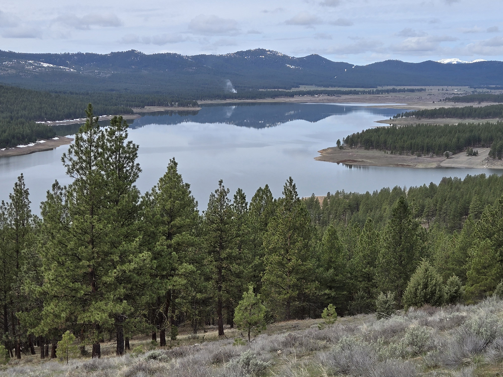
Three miles past Sumpter the byway intersects with Highway 7, which the route follows for 25 miles to Baker City, passing Phillips Reservoir on the way.
The reservoir is refreshingly large this summer, holding much more water than it has during the previous five drought-plagued years.
Marketplace


-
eEdition

-

-
