A jewel in the rough (road)
Published 3:14 pm Friday, May 26, 2017
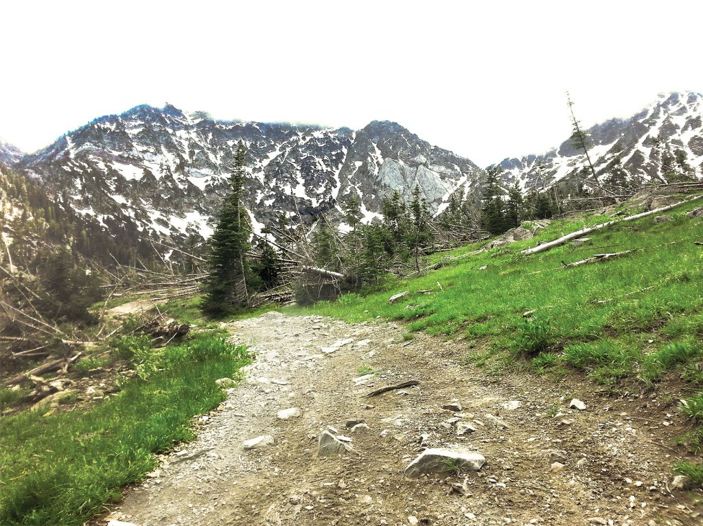
- The Pine Creek Road, in the Elkhorn Mountains northwest of Baker City, climbs to an alpine zone that includes views of Rock Creek Butte, upper right, at 9,106 feet the tallest peak in the range. Before it reaches this point the road runs through private property, and the owner, David McCarty, in 2021 filed a civil lawsuit against Baker County contending there are no records showing the road is a public right-of-way.
The route to Pine Creek Reservoir near Baker City is technically a road, but I suspect many people who make the trek end up calling it something else.
Trending
Some of these names are not appropriate for a newspaper.
Among local mammals, I believe only mountain goats — which you might well see gamboling about the cliffs above the reservoir — would consider the trip an easy one.
For people, no matter if we’re on two feet or four wheels, the journey is rather more arduous.
Trending
But also worth the effort.
Although your shock absorbers, whether of cartilage or steel, might quibble about that.
The way to this reservoir at the base of Rock Creek Butte, highest peak in the Elkhorns at 9,106 feet, is a road in the sense that wheeled vehicles can travel on it.
But even by the relatively low standards of forest roads, this one ranks in the bottom 1 percent.
Its combination of steep grades and a tread interrupted with monotonous regularity by rocks which creep uncomfortably close, in terms of size, to what most people would refer to as a boulder, make the road wholly unsuitable to most rigs, including many four-wheel drives that cavort in TV commercials.
It’s possible to make the trip in a standard pickup truck or SUV that has a low-geared transfer case, but the odds are considerable that you’ll dent some part of the vehicle that doesn’t respond well to dents.
A four-wheel ATV is the better vehicular choice, not least because of its greater maneuverability.
If you’re hiking, of course, you needn’t worry about busting an axle or shredding a tire on an obstinate chunk of limestone.
But with 2,300 feet of elevation to gain over about four miles, your legs will take a pounding, and your lungs won’t get much of a breather, so to speak.
The rate of climb exceeds that of many hiking trails which make no pretense of being roads.
Indeed, compared with the generally gentle, horse-friendly switchbacking trails that predominate in the Eagle Cap Wilderness, the hike to Pine Creek Reservoir ranks as a considerable athletic challenge.
Whatever difficulties you experience along the way, though, they’re apt to seem trivial when you crest the final rise and the reservoir comes into view with its backdrop of cliffs and spire-shaped subalpine firs. It is almost a caricature of alpine scenery, but no less beautiful for that.
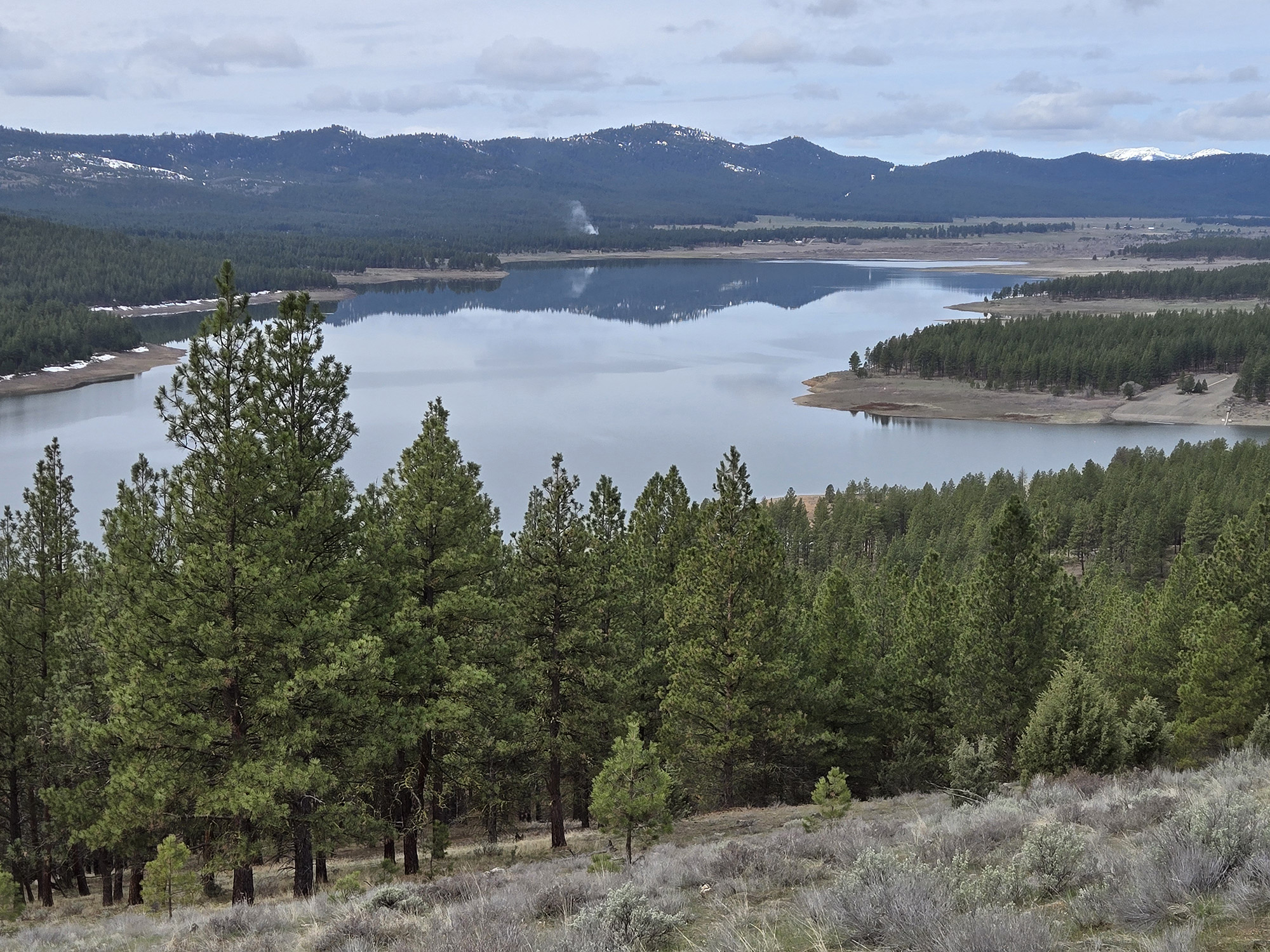
The maps denote this body of water as a reservoir, which is accurate enough, as a man-made dam impounds water that will irrigate alfalfa, potatoes and other crops in the Baker Valley below.
But calling it a lake would meet geographic muster as well, as the dam merely enlarged the water-holding capacity that nature — and specifically an Ice Age glacier — carved from the Elkhorns’ sedimentary backbone.
The setting is among the more spectacular in a region that’s hardly deficient in that category.
This has much to do with the sheer scale of the surroundings. At 6,552 feet, Pine Creek Reservoir is the lowest of the major lakes in the Elkhorns. Yet its basin lies literally at the base of not only Rock Creek Butte, but also of Elkhorn Peak, at 8,931 feet the second-tallest peak in the range.
No other lake in the Elkhorns boasts as much as 2,600 feet of relief from lake surface to summit.
The road, such as it is, continues for another mile and a half or so beyond the reservoir, finally ending in a nearly treeless basin.
From there a rough scramble trail climbs over a limestone fin and drops several hundred feet to Rock Creek Lake.
This is an alternative route to that lake, the other being a trail from Rock Creek Road, one drainage to the north.
There are several established campsites on the north shore of Pine Creek Reservoir. Like most of the lakes in the Elkhorns, it contains brook trout.
The Pine Creek basin is one of the favorite haunts of mountain goats. The Oregon Department of Fish and Wildlife released the first batch of goats here in 1983, and today the herd in the Elkhorns numbers more than 300.
By midsummer, when most of the snow has melted, the goats are easier to pick out — just look for what seem to be tiny snowdrifts that move more than snowdrifts typically do.
RESPECT PRIVATE PROPERTY
For much of its length the Pine Creek Road passes through private property. If you make the trip, stay on the road itself. Large signs, put up by the Baker County Road Department, designate the boundary between public and private property. The reservoir itself is on national forest land.
IF YOU GO…
There’s no official trailhead for Pine Creek Reservoir, possibly because the route is officially a road. But there is room for several vehicles to park at the point where the road abruptly changes from graded gravel to, well, something much rougher.
If you’re coming from La Grande or other points north, take Highway 30 to Haines. Then turn right onto the Anthony Lakes Highway and follow it for about a mile to the first corner. Veer left here onto Pocahontas Road.
• Drive south on Pocahontas, a perfectly straight two-lane paved road, for five miles to the intersection with Pine Creek Lane. Turn right.
• Follow Pine Creek Lane, also a two-lane paved road, west toward the Elkhorns for 1.75 miles to a “T” junction. Turn right (still on Pine Creek Lane).
• Drive north for about an eighth of a mile then turn left. This is still Pine Creek Lane, but the pavement gives way to gravel.
• The gravel peters out after about a mile. From there it’s about four miles to the reservoir. You’ll cross a couple of creeks along the way, most notably the North Fork of Pine Creek, about 1.2 miles from the end of the gravel. There is a rudimentary bridge — a trio of logs — to make a dry-footed crossing easy. If you’re driving, the creek is an easy ford.
If you’re coming from Baker City or points south, drive north on 10th Street and turn left onto Pocahontas. From that junction it’s 8.7 miles to the Pine Creek Lane intersection. From there follow the directions as above.
Marketplace


-
eEdition

-

-
